|
| I serve on the executive board of The Resilient by Design Challenge: Bay Area team, which has landed a $4.6 million grant from the Rockefeller Foundation for a $5.8 million competition to design demonstration solutions to adapt to sea level rise in the San Francisco Bay Area. Areas with low-lying geography like Richmond could be the subject of individual designs.
The diagram below from Tom Leader shows areas of Richmond at risk from both sea level rise and liquefaction resulting from an earthquake on the Hayward Fault.
The following story will appear in tomorrow’s San Francisco Chronicle:
Lab explores projects to lessen effects of sea level rise on SF Bay
By John King, San Francisco Chronicle
January 22, 2017 Updated: January 22, 2017 7:44pm
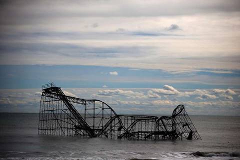
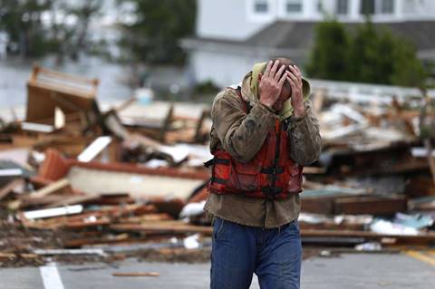
Photo: Mark Wilson, Getty Images
Atlantic Ocean waters flood a roller coaster after Superstorm Sandy hit on Nov. 1, 2012, in Seaside Heights, N.J. A Bay Area project will explore ways to lessen the effects of sea-level rise.
The Bay Area will soon be a laboratory that tests how urban regions can prepare for the likelihood of sea level rise.
That’s the aim of a $5.8 million design competition being announced this week that will select 10 multidisciplinary teams and assign each a different bayside setting. Each team will have $250,000 to work with and is expected to come up with a proposal that not only looks good but can become reality and has the support of the community where it is located.
Dubbed Bay Area: Resilient by Design, the competition has been slow to get off the ground because of fundraising difficulties. Now the New York-based Rockefeller Foundation has agreed to provide $4.6 million to pull off the ambitious 15-month effort.
“This is a great opportunity for our region to start thinking about what the future holds and how to manage that future in a way that’s exciting,” said Allison Brooks, executive director of the Bay Area Regional Collaborative and one of 12 members of the competition’s executive committee.
The competition is modeled on Rebuild by Design, which was launched in 2013 in New York and New Jersey. That effort was part of larger recovery efforts in response to the cataclysmic damage from Hurricane Sandy a few months earlier.
This time the hope is to get ahead of the curve.
“We were drawn to the idea of working with a region on a competition that’s about preparation, not recovery,” said Dr. Judith Rodin, president of the Rockefeller Foundation, which also had a central role in Rebuild by Design. “I love the idea that the setting is the Bay Area, which is so well-known for its energy and innovation.”
The setting is also known for the body of water that defines it, an estuary that extends roughly 50 miles from San Jose in the south to Napa County in the north. That range exposes it to the threats posed by sea level rise, which is related to climate change and is expected to increase in coming decades. Tides could climb as much as 66 inches by 2100 in the Bay Area, according to forecasts done in 2012 by the National Research Council.
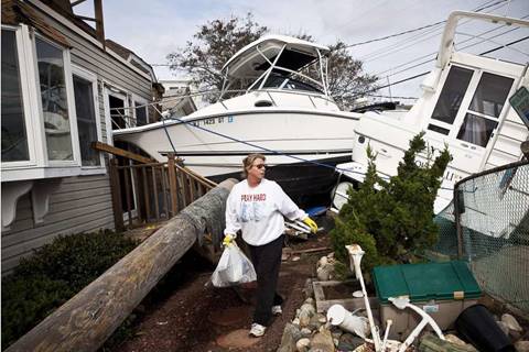
Photo: Andrew Burton, Getty Images
Regina Yahara-Splain cleans out her home after it was damaged by Superstorm Sandy in Highlands, N.J., in 2012.

John Constantine makes his way out of his house after winds from Hurricane Sandy toppled a tree fell onto it in Andover, Mass., in 2012.
Photo: Winslow Townson, Associated Press
Image 3 of 3
Brian Hajeski, 41, of Brick, N.J., reacts after looking at debris of a home that washed up on to the Mantoloking Bridge the morning after superstorm Sandy rolled through in 2012.
Photo: Julio Cortez, Associated Press
Some of those vulnerabilities were explored in The Chronicle’s Rising Reality series last year, from environmentally rich wetlands that would be engulfed to highways that would be submerged during even moderate storms. If nothing is done during the next few decades, for instance, a severe storm coupled with high tides could send water spilling into San Francisco’s Market Street subway.
Resilient by Design will identify 10 sites around the region, at least one in each of the nine counties and each posing a different type of challenge. Then the design teams will submit their qualifications in an attempt to be one of the chosen 10.
The schedule calls for teams to be selected by summer, followed by a research period where the finalists will study the ecology and infrastructure for the different sites. They’ll also meet with community activists and the public.
“The entire effort really has to be open and transparent, allowing people to weigh in,” Brooks said. “We have a long track record of planners and engineers going into communities and concocting ‘remedies’ that end up having deleterious effects.”
The final six months of the competition would be where the research is translated into design concepts that, theoretically, will be visually enticing but also scientifically sound. Something that can be financed and something that wary citizens will embrace.
“We’re going to really challenge the teams to think about multiple returns, to design things that can benefit as many people as possible,” Rodin said.
Though the Rockefeller Foundation will have a seat on Resilient by Design’s executive committee, the staff will be local.
“When you’ve got a major national foundation investing, it starts to wake people up beyond the region,” said Zack Wasserman, who chairs the Bay Conservation and Development Commission. That agency, which oversees changes proposed for the bay and its shoreline, last year voted to update its planning documents to take a more proactive approach to sea level rise.
“We describe what we’re doing as a 10-year campaign,” Wasserman said. “We need to figure out what we can do, what we should do — and how to pay for it.”
That could be tough.
Unlike in the aftermath of Hurricane Sandy, there’s no pool of disaster relief funds. A page on climate change was purged from the White House website after President Trump’s inauguration. And while several of Trump’s cabinet nominees last week testified to Congress that they believe climate change is real, they didn’t indicate there was an urgent need to try to lessen its impacts.
Bay Area voters, by contrast, in June passed Measure AA — a 20-year parcel tax that will raise an estimated $500 million for bay restoration and improvement efforts. The hope is that commitments such as this and Resilient by Design will attract other sources of funding to prepare for sea level rise.
“This is not a future concern. It’s something we need to grapple with right now,” said Adrian Covert, a vice president of the Bay Area Council, a business-sponsored think tank. “If we have the chance to get ahead of something that will be a major challenge, we should do it.”
John King is The San Francisco Chronicle’s urban design critic. Email: jking@sfchronicle.com Twitter: @johnkingsfchron |
|